↓
 

Toledo Land Surveying

Local Land Surveyors in Toledo, OH

Toledo Land Surveying
  • Home
  • ALTA Survey
  • Boundary Surveying
  • Construction Survey
  • Drone LiDAR Mapping
  • Elevation Certificate
  • Land Surveying
  • Topographic Survey
  • Contact Us
Home→construction→How To Find Your Home On FEMA's Flood Insurance Rate Maps →GIS with Flood Hazard Zone Overlay

Image navigation

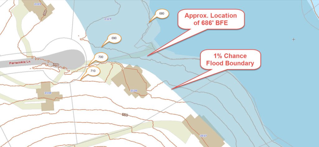
GIS with Flood Hazard Zone Overlay

Published March 6, 2016 at 1024 × 472 in How To Find Your Home On FEMA’s Flood Insurance Rate Maps
flood survey - elevation certificate

Image navigation

Get Quote Button
© Toledo Land Surveying
Toledo, Ohio
Phone: (567) 331 3274

Web Development and SEO by:
N2Biz.co


Privacy Policy | Terms of Use

The owner of this website, USA Surveying & Engineering, LLC., provides coordination of professional land surveying and engineering services in all 50 states. The professional surveying and engineering services provided to you will be conducted by fully licensed professionals in your state.

↑
Notice: ob_end_flush(): Failed to send buffer of zlib output compression (1) in /home/qrst/web/toledolandsurveying.com/public_html/wp-includes/functions.php on line 5481

Notice: ob_end_flush(): Failed to send buffer of zlib output compression (1) in /home/qrst/web/toledolandsurveying.com/public_html/wp-includes/functions.php on line 5481